Where am I in the sky?
October 28, 2023
When I was flying back from the Spatial Data Science Across Langauge event from Frankfurt to Atlanta the plane I was bored beyond measure. The plane had no wifi to connect to. I had already watched a movie and couldn’t be bothered by a podcast. I wanted to know where I was.
When looking at the onboard “About this flight” information, they didn’t show a map even. The gave us our coordinates in degrees and minutes. Helpful right?
Well, in an attempt to figure out where the hell I was I wrote some code. Here it is.
Linking to GEOS 3.13.0, GDAL 3.8.5, PROJ 9.5.1; sf_use_s2() is TRUE
udunits database from /Library/Frameworks/R.framework/Versions/4.6-arm64/Resources/library/units/share/udunits/udunits2.xml
#' Given degrees and minutes calculate the coordinate
#' in degrees
{
d <-
m <- |>
d + m
}
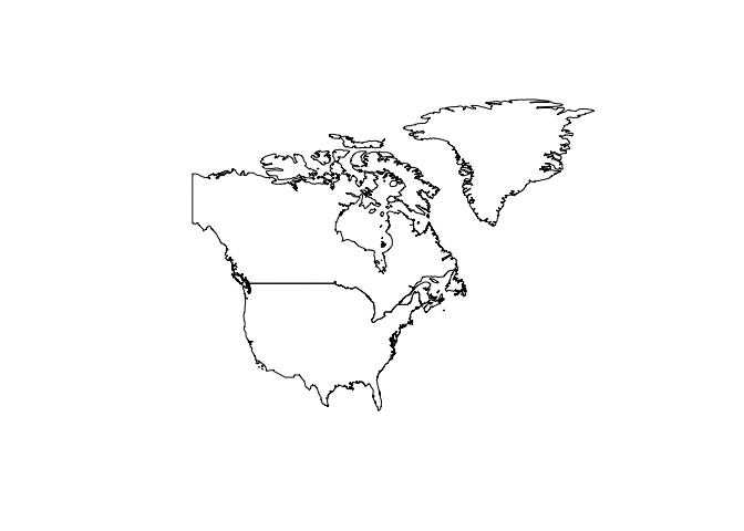
# get the country shapes
x <- rnaturalearthdata::countries50 |>
# filter to North America
usa <- x |>
dplyr:: |>
# Create a bounding box to crop myself to
crp <-
# plot N. America
usa |>
|>
|>
|>
# add planes location.